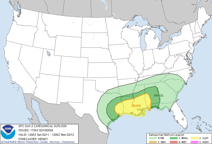
As We move into Sunday California begins its recover from all the intense Flooding caused by the Atmospheric River , but as we move into Day 2 we have a Slight risk of Severe Thunderstorms with 5-15% chance of Hail in parts of Texas, Louisiana, Mississippi, and Alabama.
Figure 2-1
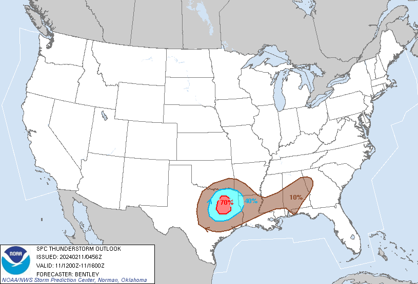
There is a Possibility of Severe Thunderstorms in southeast Texas Capable of forming Large Hail and Tornadoes with damaging wind gusts. While intensification and convection may happen, it is expected to occur late Sunday and Early Monday morning. Some Convection may occur in Eastern parts of Texas close to the cold front and Upper-Level Trough on Sunday, but parts of Louisiana and Mississippi may begin to allow storms to organize into Supercells and line segments with the potential for Tornadoes.
Figure 2-2
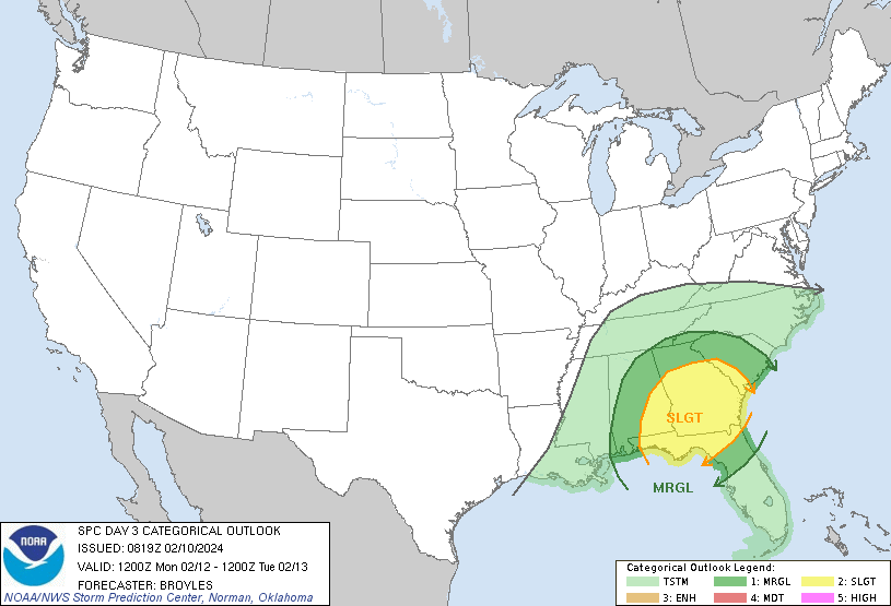
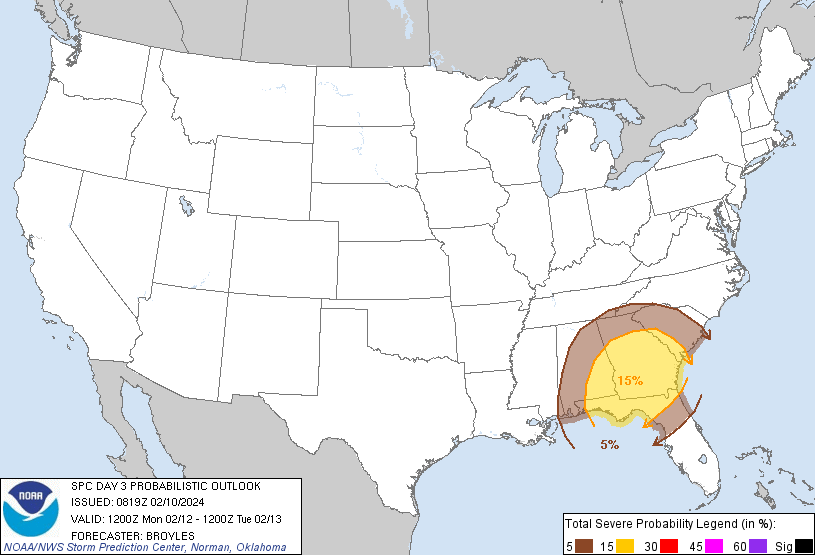
Moving into Day 3 we see Severe Thunderstorms clusters with the potential of isolated wind damage and Tornado Threats that will be likely to spread across parts of the Southeast including Georgia and Florida on Monday being primarily affected. The severe threat of thunderstorms producing high winds and tornados could continue into the evening.
Summary
California is recovering from intense flooding caused by an Atmospheric River. On Day 2, there’s a slight risk of severe thunderstorms in parts of Texas, Louisiana, Mississippi, and Alabama with a 5-15% chance of hail. Southeast Texas may experience severe thunderstorms with large hail, tornadoes, and damaging winds late Sunday into Monday. Day 3 brings severe thunderstorm clusters with the potential for isolated wind damage and tornado threats across the Southeast, including Georgia and Florida, persisting into the evening.